Editors Note
This is Book III – Part I of the thirty seven books in Plinys’ Natural History. In order to make the collection more accessible and easier to navigate, I have divided the books into several parts. This book has been divided into four parts.
Part I – Introduction, Boundaries and Gulfs of Europe, Spain, Gallia
Part II – On Italy, First, Third, Seventh and Ninth Regions of Italy
Part III – Sixty-four Islands, Baleares, Corsica, Sardinia, Sicily, Regions of Italy
Part IV – On Istria, The Alps, Dalmatia, Islands of the Inonian Sea and the Adriatic
Translated by John Bostock MD, F.R.S (1773-1846) and Henry T. Riley Esq., B.A. (1816-1878), first published 1855. No changes have been made to the text, however all footnotes have been removed.
BOOK III.
AN ACCOUNT OF COUNTRIES, NATIONS, SEAS, TOWNS, HAVENS, MOUNTAINS, RIVERS, DISTANCES, AND PEOPLES WHO NOW EXIST OR FORMERLY EXISTED.
INTRODUCTION.
Thus far have I treated of the position and the wonders of the earth, of the waters, the stars, and the proportion of the universe and its dimensions. I shall now proceed to describe its individual parts; although indeed we may with reason look upon the task as of an infinite nature, and one not to be rashly commenced upon without incurring censure. And yet, on the other hand, there is nothing which ought less to require an apology, if it is only considered how far from surprising it is that a mere mortal cannot be acquainted with everything. I shall therefore not follow any single author, but shall employ, in relation to each subject, such writers as I shall look upon as most worthy of credit. For, indeed, it is the characteristic of nearly all of them, that they display the greatest care and accuracy in the description of the countries in which they respectively flourished; so that by doing this, I shall neither have to blame nor contradict any one.
The names of the different places will here be simply given, and as briefly as possible; the account of their celebrity, and the events which have given rise thereto, being deferred to a more appropriate occasion; for it must be remembered that I am here speaking of the earth as a whole, and I wish to be understood as using the names without any reference whatever to their celebrity, and as though the places themselves were in their infancy, and had not as yet acquired any fame through great events. The name is mentioned, it is true, but only as forming a part of the world and the system of the universe.
The whole globe is divided into three parts, Europe, Asia, and Africa. Our description commences where the sun sets and at the Straits of Gades, where the Atlantic ocean, bursting in, is poured forth into the inland seas. As it makes its entrance from that side, Africa is on the right hand and Europe on the left; Asia lies between them; the boundaries being the rivers Tanais and Nile. The Straits of the ocean, of which I have just spoken, extend fifteen miles in length and five in breadth, measured from the village of Mellaria in Spain to the Album Promontorium or White Promontory in Africa, as we learn from Turranius Gracilis, who was born in that vicinity. Titus Livius and Cornelius Nepos however have stated the breadth, where it is least, to be seven miles, and where greatest, ten; from so small a mouth as this does so immense an expanse of water open upon us! Nor is our astonishment diminished by the fact of its being of great depth; for, instead of that, there are numerous breakers and shoals, white with foam, to strike the mariner with alarm. From this circumstance it is, that many have called this spot the threshold of The Inland Sea.
At the narrowest part of the Straits, there are mountains placed to form barriers to the entrance on either side, Abyla in Africa, and Calpe in Europe, the boundaries formerly of the labours of Hercules. Hence it is that the inhabitants have called them the Columns of that god; they also believe that they were dug through by him; upon which the sea, which was before excluded, gained admission, and so changed the face of nature.
CHAP. 1. —THE BOUNDARIES AND GULFS OF EUROPE FIRST SET FORTH IN A GENERAL WAY.
I shall first then speak of Europe, the foster-mother of that people which has conquered all other nations, and itself by far the most beauteous portion of the earth. Indeed, many persons have, not without reason, considered it, not as a third part only of the earth, but as equal to all the rest, looking upon the whole of our globe as divided into two parts only, by a line drawn from the river Tanais to the Straits of Gades. The ocean, after pouring the waters of the Atlantic through the inlet which I have here described, and, in its eager progress, overwhelming all the lands which have had to dread its approach, skirts with its winding course the shores of those parts which offer a more effectual resistance, hollowing out the coast of Europe especially into numerous bays, among which there are four Gulfs that are more particularly remarkable. The first of these begins at Calpe, which I have previously mentioned, the most distant mountain of Spain; and bends, describing an immense curve, as far as Locri and the Promontory of Bruttium.
CHAP. 2.—OF SPAIN GENERALLY.
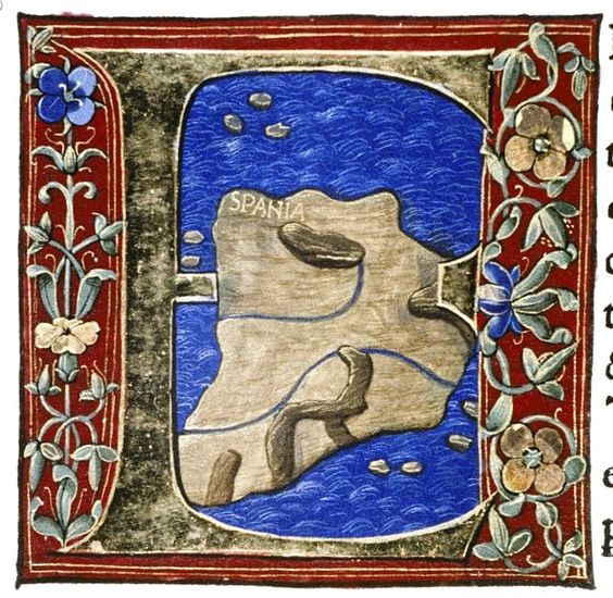
The first land situate upon this Gulf is that which is called the Farther Spain or Bætica; next to which, beginning at the frontier town of Urgi, is the Nearer, or Tarraconensian
Spain, extending as far as the chain of the Pyrenees. The Farther Spain is divided lengthwise into two provinces, Lusitania and Bætica, the former stretching along the northern side of the latter, and being divided from it by the river Ana.
The source of this river is in the district of Laminium, in the Nearer Spain. It first spreads out into a number of small lakes, and then again contracts itself into a narrow channel, or entirely disappears under ground, and after frequently disappearing and again coming to light, finally discharges itself into the Atlantic Ocean. Tarraconensian Spain lies on one side, contiguous to the Pyrenees, running downwards along the sides of that chain, and, stretching across from the Iberian Sea to the Gallic ocean, is separated from Bætica and Lusitania by Mount Solorius, the chains of the Oretani and the Carpetani, and that of the Astures.
CHAP. 3.—OF BÆTICA.
Bætica, so called from the river which divides it in the middle, excels all the other provinces in the richness of its cultivation and the peculiar fertility and beauty of its vegetation.
It consists of four jurisdictions, those of Gades, of Corduba, of Astigi, and of Hispalis. The total number of its towns is 175; of these nine are colonies, and eight municipal towns; twenty-nine have been long since presented with the old Latin rights; six are free towns, three federate, and 120 tributary.
In this district, the things that more especially deserve notice, or are more easily explained in the Latin tongue, are the following, beginning at the river Ana, along the line of the sea-shore; the town of Onoba, surnamed Æstuaria; the rivers Luxia and Urium, flowing through this territory between the Ana and the Bætis; the Marian Mountains; the river Bætis; the coast of Corum, with its winding bay; opposite to which is Gades, of which we shall have occasion to speak among the islands. Next comes the Promontory of Juno, and the port of Bæsippo; the towns of Bœlo and Mellaria, at which latter begin the Straits of the Atlantic; Carteia, called by the Greeks Tartessos; and the mountain of Calpe.
Along the coast of the inland sea is the town of Barbesula with its river; also Salduba; the town of Suel; and then Malaca, with its river, one of the federate towns. Next to this comes Mænoba, with its river; then Sexifirmum, surnamed Julium; Selambina; Abdera; and Murci, which is at the boundary of Bætica. M. Agrippa supposed that all this coast was peopled by colonists of Punic origin. Beyond the Anas, and facing the Atlantic, is the country of the Bastuli and the Turditani. M. Varro informs us, that the Iberians, the Persians, the Phœnicians, the Celts, and the Carthaginians spread themselves over the whole of Spain; that the name “Lusitania” is derived from the games (lusus) of Father Bacchus, or the fury (lyssa) of his frantic attendants, and that Pan was the governor of the whole of it. But the traditions respecting Hercules and Pyrene, as well as Saturn, I conceive to be fabulous in the highest degree.
The Bætis does not rise, as some writers have asserted, near the town of Mentisa, in the province of Tarraco, but in the Tugiensian Forest; and near it rises the river Tader, which waters the territory of Carthage. At Ilorcum it turns away from the Funeral Pile of Scipio; then taking a sweep to the left, it falls into the Atlantic Ocean, giving its name to this province: at its source it is but small, though during its course it receives many other streams, which it deprives as well of their waters as their renown. It first enters Bætica in Ossigitania, and glides gently, with a smooth current, past many towns situate on either side of its banks.
Between this river and the sea-shore the most celebrated places inland are Segida, also surnamed Augurina; Julia, called Fidentia; Urgao or Alba, Ebora or Cerealis, Iliberri or Liberini, Ilipula or Laus, Artigi or Julienses, Vesci or Faventia, Singili, Attegua, Arialdunum, Agla Minor, Bæbro, Castra Vinaria, Cisimbrium, Hippo
Nova or New Hippo, Ilurco, Osca, Escua, Sucubo, Nuditanum, Old Tuati; all which towns are in that part of Bastitania which extends towards the sea, but in the jurisdiction of Corduba. In the neighbourhood of the river itself is Ossigi, also surnamed Laconicum, Iliturgi or Forum Julium, Ipasturgi or Triumphale, Setia, and, fourteen miles inland, Obulco, which is also called Pontificense.
Next to these comes Epora, a federate town, Sacili Martialium, and Onoba. On the right bank is Corduba, a Roman colony, surnamed Patricia; here the Bætis first becomes navigable. There are also the towns of Carbula and Detunda, and the river Singulis, which falls into the Bætis on the same side.
The towns in the jurisdiction of Hispalis are the following: Celti, Arua, Canama, Evia, Ilipa, surnamed Illa, and Italica. On the left of the river is the colony of Hispalis named Romuliensis, and, on the opposite side, the town of Osset, surnamed Julia Constantia, Vergentum, or Julî Genius, Orippo, Caura, Siarum, and the river Menoba, which enters the Bætis on its right bank. Between the æstuaries of the Bætis lie the towns of Nebrissa, surnamed Veneria, and of Colobona. The colonies are, Asta, which is also called Regia, and, more inland, that of Asido, surnamed Cæsariana.
The river Singulis, discharging itself into the Bætis at the place already mentioned, washes the colony of Astigi, surnamed Augusta Firma, at which place it becomes navigable. The other colonies in this jurisdiction which are exempt from tribute are Tucci, surnamed Augusta Gemella, Itucci called Virtus Julia, Attubi or Claritas Julia, Urso or Genua Urbanorum; and among them in former times Munda, which was taken with the son of Pompey. The free towns are Old Astigi and Ostippo; the tributary towns are Callet, Callecula, Castra Gemina, the Lesser Ilipula, Merucra, Sacrana, Obulcula, and Oningis. As you move away from the sea-coast, near where the river Menoba is navigable, you find, at no great distance, the Alontigiceli and the Alostigi.
The country which extends from the Bætis to the river Anas, beyond the districts already described, is called Bæturia, and is divided into two parts and the same number of nations; the Celtici, who border upon Lusitania, in the jurisdiction of Hispalis, and the Turduli, who dwell on the verge of Lusitania and Tarraconensis, and are under the protection of the laws of Corduba. It is evident that the Celtici have sprung from the Celtiberi, and have come from Lusitania, from their religious rites, their language, and the names of their towns, which in Bætica are distinguished by the following epithets, which have been given to them. Seria has received the surname of Fama Julia, Nertobriga that of Concordia Julia, Segida that of Restituta Julia, and Contributa that of Julia. What is now Curiga was formerly Ucultuniacum, Constantia Julia was Laconimurgis, the present Fortunales were the Tereses, and the Emanici were the Callenses. Besides these, there are in Celtica the towns of Acinippo, Arunda, Aruci, Turobriga, Lastigi, Salpesa, Sæpone, and Serippo.
The other Bæturia, which we have mentioned, is inhabited by the Turduli, and, in the jurisdiction of Corduba, has some towns which are by no means inconsiderable; Arsa Mellaria, Mirobriga, and Sisapo, in the district of Osintias.
To the jurisdiction of Gades belongs Regina, with Roman citizens; and Læpia, Ulia, Carisa surnamed Aurelia, Urgia or Castrum Julium, likewise called Cæsaris Salutariensis, all of which enjoy the Latian rights. The tributary towns are Besaro, Belippo, Barbesula, Lacippo, Bæsippo, Callet, Cappacum, Oleastro, Ituci, Brana, Lacibi, Saguntia, and Audorisæ.
M. Agrippa has also stated the whole length of this province to be 475 miles, and its breadth 257; but this was at a time when its boundaries extended to Carthage, a circumstance which has often caused great errors in calculations; which are generally the result either of changes effected in the limits of provinces, or of the fact that in the reckoning of distances the length of the miles has been arbitrarily increased or diminished. In some parts too the sea has been long making encroachments upon the land, and in others again the shores have advanced; while the course of rivers in this place has become more serpentine, in that more direct. And then, besides, some writers begin their measurements at one place, and some at another, and so proceed in different directions; and hence the result is, that no two accounts agree.
At the present day the length of Bætica, from the town of Castulo, on its frontier, to Gades is 250 miles, and from Murci, which lies on the sea-coast, twenty-five miles more. The breadth, measured from the coast of Carteia, is 234 miles. Who is there that can entertain the belief that Agrippa, a man of such extraordinary diligence, and one who bestowed so much care on his subject, when he proposed to place before the eyes of the world a survey of that world, could be guilty of such a mistake as this, and that too when seconded by the late emperor the divine Augustus? For it was that emperor who completed the Portico which had been begun by his sister, and in which the survey was to be kept, in conformity with the plan and descriptions of M. Agrippa.
CHAP. 4. —OF NEARER SPAIN.
The ancient form of the Nearer Spain, like that of many other provinces, is somewhat changed, since the time when Pompey the Great, upon the trophies which he erected in the Pyrenees, testified that 877 towns, from the Alps to the borders of the Farther Spain, had been reduced to subjection by him. The whole province is now divided into seven jurisdictions, those of Carthage, of Tarraco, of Cæsar Augusta, of Clunia, of Asturica, of Lucus, and of the Bracari. To these are to be added the islands, which will be described on another occasion, as also 293 states which are dependent on others; besides which the province contains 179 towns. Of these, twelve are colonies, thirteen, towns with the rights of Roman citizens, eighteen with the old Latian rights, one confederate, and 135 tributary.
The first people that we come to on the coast are the Bastuli; after whom, proceeding according to the order which I shall follow, as we go inland, there are the Mentesani, the Oretani, and the Carpetani on the Tagus, and next to them the Vaccæi, the Vectones, and the Celtiberian Arevaci. The towns nearest to the coast are Urci, and Barea included in Bætica, the district of Mavitania, next to it Deitania, and then Contestania, and the colony of Carthago Nova; from the Promontory of which, known as the Promontorium Saturni, to the city of Cæsarea in Mauritania, the passage is a distance of 187 miles. The remaining objects worthy of mention on the coast are the river Tader, and the free colony of Ilic, whence the Ilicitanian Gulf derives its name; to this colony the Icositani are subordinate.
We next have Lucentum, holding Latian rights; Dianiu, a tributary town; the river Sucro, and in former times a town of the same name, forming the frontier of Contestania.
Next is the district of Edetania, with the delightful expanse of a lak before it, and extending backward to Celtiberia. Valentia, a colony, is situate three miles from the sea, after which comes the river Turium, and Saguntum at the same distance, a town of Roman citizens famous for its fidelity, the river Uduba, and the district of the Ilergaones. The Iberus, a river enriched by its commerce, takes its rise in the country of the Cantabri, not far from the town of Juliobriga, and flows a distance of 450 miles; 260 of which, from the town of Varia namely, it is available for the purposes of navigation. From this river the name of Iberia has been given by the Greeks to the whole of Spain.
Next comes the district of Cossetania, the river Subi, and the colony of Tarraco, which was built by the Scipios as Carthage was by the Carthaginians. Then the district of the Ilergetes, the town of Subur, and the river Rubricatum, beyond which begin the Laletani and the Indigetes. Behind these, in the order in which they will be mentioned, going back from the foot of the Pyrenees, are the Ausetani, the Lacetani, and along the Pyrenees, the Cerretani, next to whom are the Vascones. On the coast is the colony of Barcino, surnamed Faventia; Bætulo and Iluro, towns with Roman citizens; the river Larnum, Blandæ, the river Alba; Emporiæ, a city consisting of two parts, one peopled by the original inhabitants, the other by the Greek descendants of the Phocæans; and the river Ticher. From this to the Venus Pyrenæa, on the other side of the Promontory, is a distance of forty miles.
I shall now proceed to give an account of the more remarkable things in these several jurisdictions, in addition to those which have been already mentioned. Forty-three different peoples are subject to the jurisdiction of the courts of Tarraco: of these the most famous are—holding the rights of Roman citizens, the Dertusani and the Bisgargitani; enjoying Latian rights, the Ausetani, and the Cerretani, both Julian and Augustan, the Edetani, the Gerundenses, the Gessorienses, and the Teari, also called Julienses. Among the tributaries are the Aquicaldenses, the Onenses, and the Bæculonenses.
Cæsar Augusta, a free colony, watered by the river Iberus, on the site of the town formerly called Salduba, is situate in the district of Edetania, and is the resort of fifty-five nations. Of these there are, with the rights of Roman citizens, the Bellitani, the Celsenses, a former colony, the Calagurritani, surnamed the Nassici, the Ilerdenses, of the nation of the Surdaones, near whom is the river Sicoris, the Oscenses in the district of Vescitania, and the Turiasonenses. Of those enjoying the rights of the ancient Latins, there are the Cascantenses, the Ergavicenses, the Graccuritani, the Leonicenses, and the Osicerdenses; of federate states, there are the Tarragenses; and of tributaries, the Arcobrigenses, the Andologenses, the Aracelitani, the Bursaonenses, the Calagurritani, who are also surnamed the Fibularenses, the Complutenses, the Carenses, the Cincenses, the Cortonenses, the Damanitani, the Larnenses, the Lursenses, the Lumberitani, the Lacetani, the Lubienses, the Pompelonenses, and the Segienses.
Sixty-five different nations resort to Carthage, besides the inhabitants of the islands. Of the Accitanian colony, there are the Gemellenses, and the town of Libisosona, surnamed Foroaugustana, to both of which have been granted Italian rights. Of the colony of Salaria, there are the people of the following towns, enjoying the rights of ancient Latium: the Castulonenses, also called the Cæsari Venales, the Sætabitani or Augustani, and the Valerienses. The best known among the tributaries are the Alabanenses, the Bastitani, the Consaburrenses, the Dianenses, the Egelestani, the Ilorcitani, the Laminitani, the Mentesani, both those called Oritani and those called Bastuli, and the Oretani who are surnamed Germani, the people of Segobriga the capital of Celtiberia, those of Toletum the capital of Carpetania, situate on the river Tagus, and after them the Viatienses and the Virgilienses.
To the jurisdiction of Clunia the Varduli contribute fourteen nations, of whom we need only particularize the Albanenses, the Turmodigi, consisting of four tribes, among which are the Segisamonenses and the Segisamaiulienses. To the same jurisdiction belong the Carietes and the Vennenses with five states, among which are the Velienses. Thither too resort the Pelendones of the Celtiberians, in four different nations, among whom the Numantini were especially famous. Also, among the eighteen states of the Vaccæi, there are the Intercatienses, the Pallantini, the Lacobrigenses, and the Caucenses. But among the seven peoples belonging to the Cantabri, Juliobriga is the only place worthy of mention; and of the ten states of the Autrigones, Tritium and Virovesca. The river Areva gives its name to the Arevaci; of whom there are six towns, Segontia and Uxama, names which are frequently given to other places, as also Segovia and Nova Augusta, Termes, and Clunia itself, the frontier of Celtiberia. The remaining portion turns off towards the ocean, being occupied by the Varduli, already mentioned, and the Cantabri.
Next upon these touch the twenty-two nations of the Astures, who are divided into the Augustani and the Transmontani, with the magnificent city of Asturica. Among these we have the Cigurri, the Pæsici, the Lancienses, and the Zoëlæ. The total number of the free population amounts to 240,000 persons.
The jurisdiction of Lucus embraces, besides the Celtici and the Lebuni, sixteen different nations, but little known and with barbarous names. The number however of the free population amounts to nearly 166,000.
In a similar manner the twenty-four states of the jurisdiction of the Bracari contain a population of 175,000, among whom, besides the Bracari themselves, we may mention, without wearying the reader, the Bibali, the Cœlerni, the Gallæci, the Hequæsi, the Limici, and the Querquerni.
The length of the Nearer Spain, from the Pyrenees to the frontier of Castulo, is 607 miles, and a little more if we follow the line of the coast; while its breadth, from Tarraco to the shore of Olarson, is 307 miles. From the foot of the Pyrenees, where it is wedged in by the near approach of the two seas, it gradually expands until it touches the Farther Spain, and thereby acquires a width more than double.
Nearly the whole of Spain abounds in mines of lead, iron, copper, silver, and gold; in the Nearer Spain there is also found lapis specularis; in Bætica there is cinnabar. There are also quarries of marble. The Emperor Vespasianus Augustus, while still harassed by the storms that agitated the Roman state, conferred the Latian rights on the whole of Spain. The Pyrenean mountains divide Spain from Gaul, their extremities projecting into the two seas on either side.
CHAP. 5. —OF THE PROVINCE OF GALLIA NARBONENSIS.
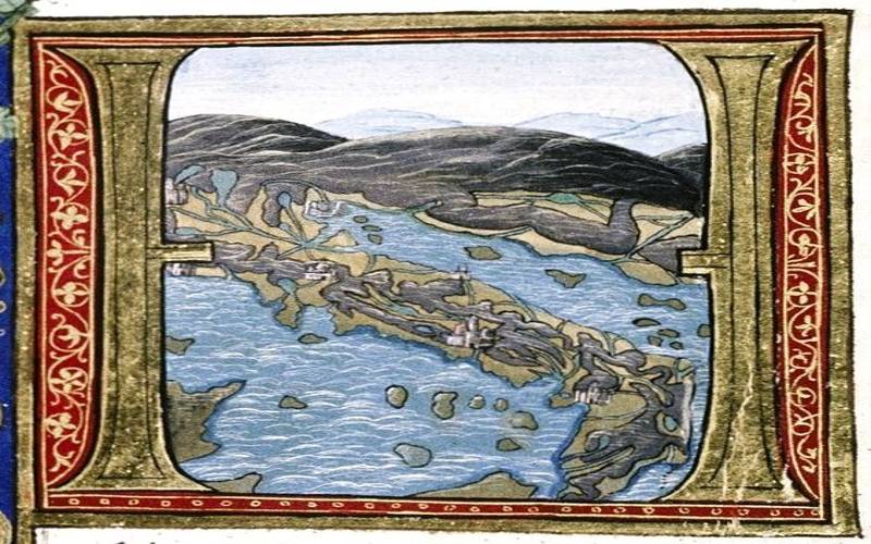
That part of the Gallias which is washed by the inland sea is called the province of [Gallia] Narbonensis, having formerly borne the name of Braccata. It is divided from Italy by the river Varus, and by the range of the Alps, the great safeguards of the Roman Empire. From the remainder of Gaul, on the north, it is separated by the mountains Cebenna and Jura. In the cultivation of the soil, the manners and civilization of the inhabitants, and the extent of its wealth, it is surpassed by none of the provinces, and, in short, might be more truthfully described as a part of Italy than as a province. On the coast we have the district of the Sordones, and more inland that of the Consuarani. The rivers are the Tecum and the Vernodubrum. The towns are Illiberis, the scanty remains of what was formerly a great city, and Ruscino, a town with Latian rights. We then come to the river Atax, which flows from the Pyrenees, and passes through the Rubrensian Lake, the town of Narbo Martius, a colony of the tenth legion, twelve miles distant from the sea, and the rivers Arauris and Liria. The towns are otherwise but few in number, in consequence of the numerous lakes which skirt the sea-shore. We have Agatha, formerly belonging to the Massilians, and the district of the Volcæ Tectosages; and there is the spot where Rhoda, a Rhodian colony, formerly stood, from which the river takes its name of Rhodanus; a stream by far the most fertilizing of any in either of the Gallias. Descending from the Alps and rushing through lake Lemanus, it carries along with it the sluggish Arar, as well as the torrents of the Isara and the Druentia, no less rapid than itself. Its two smaller mouths are called Libica, one being the Spanish, and the other the Metapinian mouth; the third and largest is called the Massiliotic. There are some authors who state that there was formerly a town called Heraclea at the mouth of the Rhodanus or Rhone.
Beyond this are the Canals leading out of the Rhone, a famous work of Caius Marius, and still distinguished by his name; the Lake of Mastramela, the town of Maritima of the Avatici, and, above this, the Stony Plains, memorable for the battles of Hercules; the district of the Anatilii, and more inland, that of the Desuviates and the Cavari. Again, close upon the sea, there is that of the Tricorii, and inland, there are the Tricolli, the Vocontii, and the Segovellauni, and, after them, the Allobroges.
On the coast is Massilia, a colony of Phocæan Greeks, and a federate city; we then have the Promontory of Zao, the port of Citharista, and the district of the Camatullici; then the Suelteri, and above them the Verrucini. Again, on the coast, we find Athenopolis, belonging to the Massilians, Forum Julii Octavanorum, a colony, which is also called Pacensis and Classica, the river Argenteus, which flows through it, the district of the Oxubii and that of the Ligauni; above whom are the Suetri, the Quariates and the Adunicates. On the coast we have Antipolis, a town with Latian rights, the district of the Deciates, and the river Varus, which proceeds from Mount Cema, one of the Alps.
The colonies in the interior are Arelate Sextanorum, Beterræ Septimanorum, and Arausio Secundanorum; Valentia in the territory of the Cavari, and Vienna in that of the Allobroges. The towns that enjoy Latian rights are Aquæ Sextiæ in the territory of the Saluvii, Avenio in that of the Cavari, Apta Julia in that of the Volgientes, Alebece in that of the Reii Apollinares, Alba in that of the Helvi, and Augusta in that of the Tricastini, Anatilia, Aeria, the Bormanni, the Comaci, Cabellio, Carcasum in the territory of the Volcæ Tectosages, Cessero, Carpentoracte in the territory of the Memini, the Cenicenses, the Cambolectri, surnamed the Atlantici, Forum Voconi, Glanum Livi, the Lutevani, also called the Foroneronienses, Nemausum in the territory of the Arecomici, Piscenæ, the Ruteni, the Sanagenses, the Tolosani in the territory of the Tectosages on the confines of Aquitania, the Tasconi, the Tarusconienses, the Umbranici, Vasio and Lucus Augusti, the two capitals of the federate state of the Vocontii. There are also nineteen towns of less note, as well as twenty-four belonging to the people of Nemausum. To this list the Emperor Galba added two tribes dwelling among the Alps, the Avantici and the Bodiontici, to whom belongs the town of Dinia. According to Agrippa the length of the province of Gallia Narbonensis is 370 miles, and its breadth 248.